


Rowan School Voting District, Forrest County, Mississippi
About
Outline

Summary
| Unique Area Identifier | 605345 |
| Name | Rowan School Voting District |
| County | Forrest County |
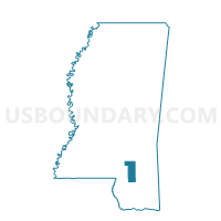
| State | Mississippi |
| Area (square miles) | 0.37 |
| Land Area (square miles) | 0.37 |
| Water Area (square miles) | 0.00 |
| % of Land Area | 100.00 |
| % of Water Area | 0.00 |
| Latitude of the Internal Point | 31.31138650 |
| Longtitude of the Internal Point | -89.29902060 |
Maps


Graphs
Select a template below for downloading or customizing gragh for Rowan School Voting District, Forrest County, Mississippi


Neighbors
Neighoring Voting District (by Name) Neighboring Voting District on the Map
- Camp School Voting District, Forrest County, MS
- Lillie Burney School Voting District, Forrest County, MS
- Salvation Army Voting District, Forrest County, MS
- Walthall School Voting District, Forrest County, MS
Top 10 Neighboring County Subdivision (by Population) Neighboring County Subdivision on the Map
Top 10 Neighboring Place (by Population) Neighboring Place on the Map
Top 10 Neighboring Unified School District (by Population) Neighboring Unified School District on the Map
Top 10 Neighboring State Legislative District Lower Chamber (by Population) Neighboring State Legislative District Lower Chamber on the Map
Top 10 Neighboring State Legislative District Upper Chamber (by Population) Neighboring State Legislative District Upper Chamber on the Map
- State Senate District 44, MS (71,264)
- State Senate District 45, MS (57,871)
- State Senate District 41, MS (56,638)